

|
360° Aerial Panoramas, and General Survey Video
|
OverviewThe project for Side Street Planning in Franklinton was a large undertaking but something we felt would allow us to flex our skill set in a municipal aerial photography setting. It involved flying down four different streets for more than a total of four miles in the air! It was a great demonstration of our long flight times and ability to utilize the waypoint functionality of our multirotor. All in all the project was somewhat complex, but one that was perfect for our skillset.
|
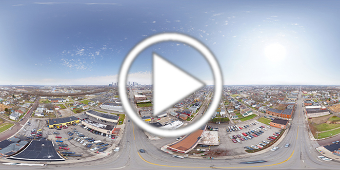
Aerial 360° Panorama TourFor best viewing: Expand the 360 image to full screen, scroll in, right click and use the "fisheye" setting. Left click, hold down and scroll around. This is a great view over the Ohio State Univeristy Campus.
|
|
Flying in a urban area attracted alot of interest which honestly was the greatest challenge. We love talking to people and explaining what we do, but there were critical times when people would come out of no where and begin to ask us questions while we were performing mission critical tasks. But in the end there were no issues so it wasn't that big of a challenge to overcome!
|
Whats Going On? |
UAV News |
Contact Us |
